Why is satellite city development the future of Vietnam’s urban landscape?
Urbanization in Vietnam is entering a transformative phase. Major cities like Hanoi and Ho Chi Minh City face immense pressure from overpopulation and strained infrastructure. Consequently, the government is shifting its focus toward satellite city development. This strategy aims to redistribute the population and economic activities away from the congested central cores.
For project developers, this shift represents a golden opportunity. Developing peripheral areas allows for larger-scale projects and innovative urban designs. Furthermore, these satellite zones offer a fresh canvas for sustainable living environments. Understanding the nuances of this transition is essential for any stakeholder in the real estate sector.
Satellite cities are not merely residential suburbs. Instead, they function as independent urban hubs with their own economic drivers. They provide essential services, employment, and high-quality infrastructure. By creating these "mini-cities," Vietnam hopes to achieve a more balanced and resilient urban hierarchy [5].
What is the historical origin of the satellite city concept?
The idea of satellite cities is not a modern invention. It dates back to the late 19th century. Ebenezer Howard introduced the "Garden City" concept in 1898. He envisioned cities that combined the benefits of urban life with the health advantages of the countryside [2]. Howard believed that people should live in harmony with nature while enjoying modern amenities.
Following Howard, Raymond Unwin expanded these ideas into the "satellite town" theory in 1922. He proposed a network of small towns surrounding a major central city. These towns would remain relatively independent but stay connected to the core. This model aimed to prevent the "bloating" of major metropolises after World War II [2].
Global examples of successful satellite cities abound. London has Welwyn and Letchworth. Paris developed Cergy-Pontoise and Marne-la-Vallée. Even Moscow and New York implemented similar strategies to manage growth. These international experiences serve as a blueprint for satellite city development in Vietnam today.
How is Hanoi transitioning to a polycentric urban model?
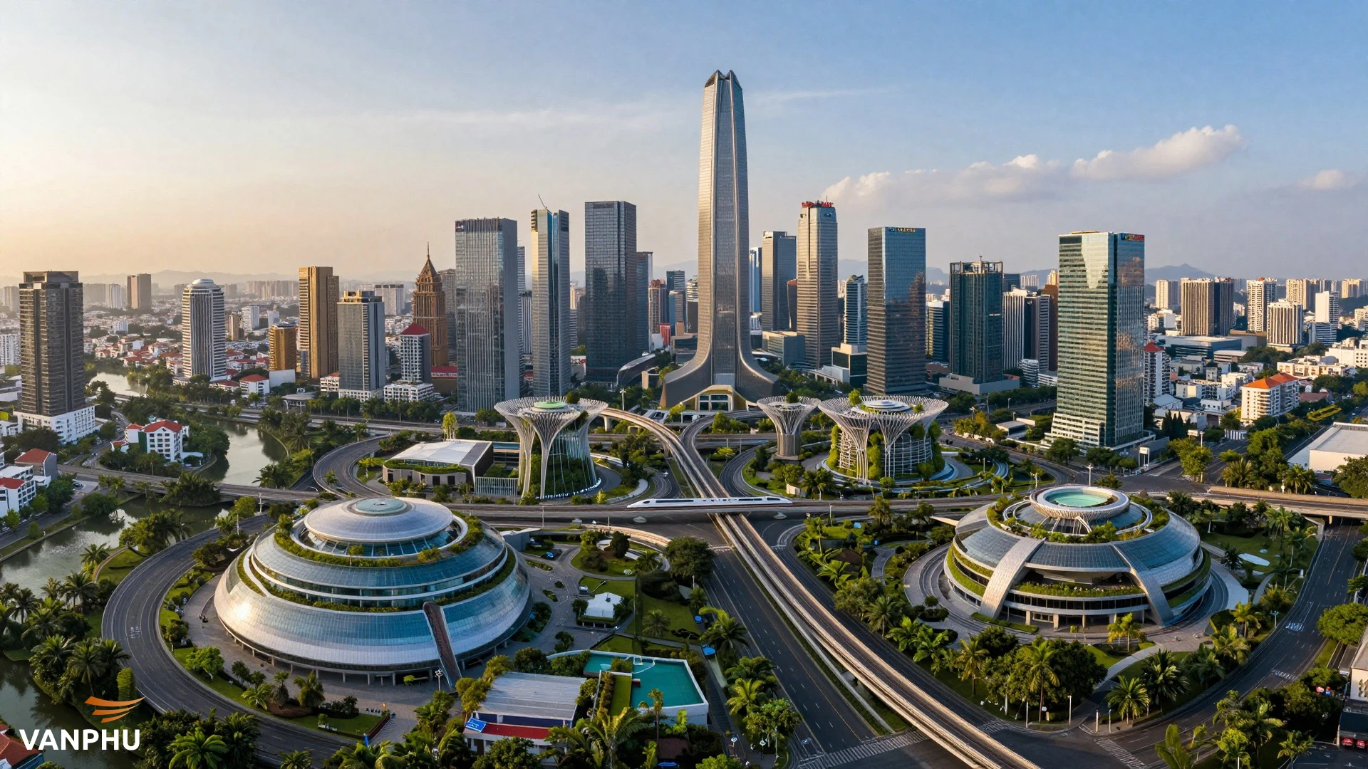
Hanoi is currently moving from a monocentric model to a polycentric one. Historically, all administrative and economic power was concentrated in the historic core. However, the new Master Plan for 2045 aims to create multiple growth poles. This "multi-center" approach helps reduce the burden on the inner city's environment and infrastructure [1].
The city is organizing its space into five distinct urban zones. These zones will support the central core by providing specialized functions. For instance, some areas will focus on technology, while others prioritize culture or logistics. This strategic distribution ensures that growth is not confined to a single point but spreads across the entire capital region [3].
Project developers such as Văn Phú are strategically positioning themselves to meet the rising demand for high-quality housing in these emerging urban clusters. By investing in these areas early, developers can secure prime land and contribute to the city's long-term vision. This shift is essential for creating a more livable and efficient capital.
Why are Son Tay and Phu Xuyen designated as the primary satellite cities?
In recent planning adjustments, Hanoi reduced its number of official satellite cities from five down to two. These are Son Tay and Phu Xuyen. This change reflects a more integrated approach to urban development. Instead of isolated satellites, the city now focuses on "axis-cluster-integrated poles" [1].
Son Tay is being developed as a cultural, heritage, and ecological city. It leverages its historical assets to attract tourism and provide a high quality of life. Conversely, Phu Xuyen is positioned as a service and logistics hub. Its location is ideal for transshipment and industrial support, connecting Hanoi to the southern provinces [3].
These two cities serve as anchors for their respective regions. They provide a balance between economic production and cultural preservation. For developers, these areas offer unique niches. Whether it is eco-resorts in Son Tay or industrial parks in Phu Xuyen, the opportunities are diverse and specialized.
What role does the "three cities within the capital" strategy play?
A groundbreaking part of Hanoi's new vision is the "three cities within the capital" concept. This involves creating three major urban entities in the North, West, and South. Each "city" will have its own administrative identity and economic focus. This model allows for more agile management and faster development [1].
The Northern City, centered around Soc Son and Dong Anh, will focus on airport logistics and clean industries. The Western City, encompassing Hoa Lac and Xuan Mai, is the hub for science, technology, and education. Meanwhile, the Southern City will drive regional trade and agriculture. This structure creates a powerful "centripetal" urban cluster [4].
This strategy is a significant departure from traditional planning. It empowers these regions to grow independently while remaining part of the greater Hanoi ecosystem. Developers can now target specific "cities" based on their expertise, whether it is high-tech office spaces or modern logistics centers.
How does Hoa Lac emerge as a technology and education hub?
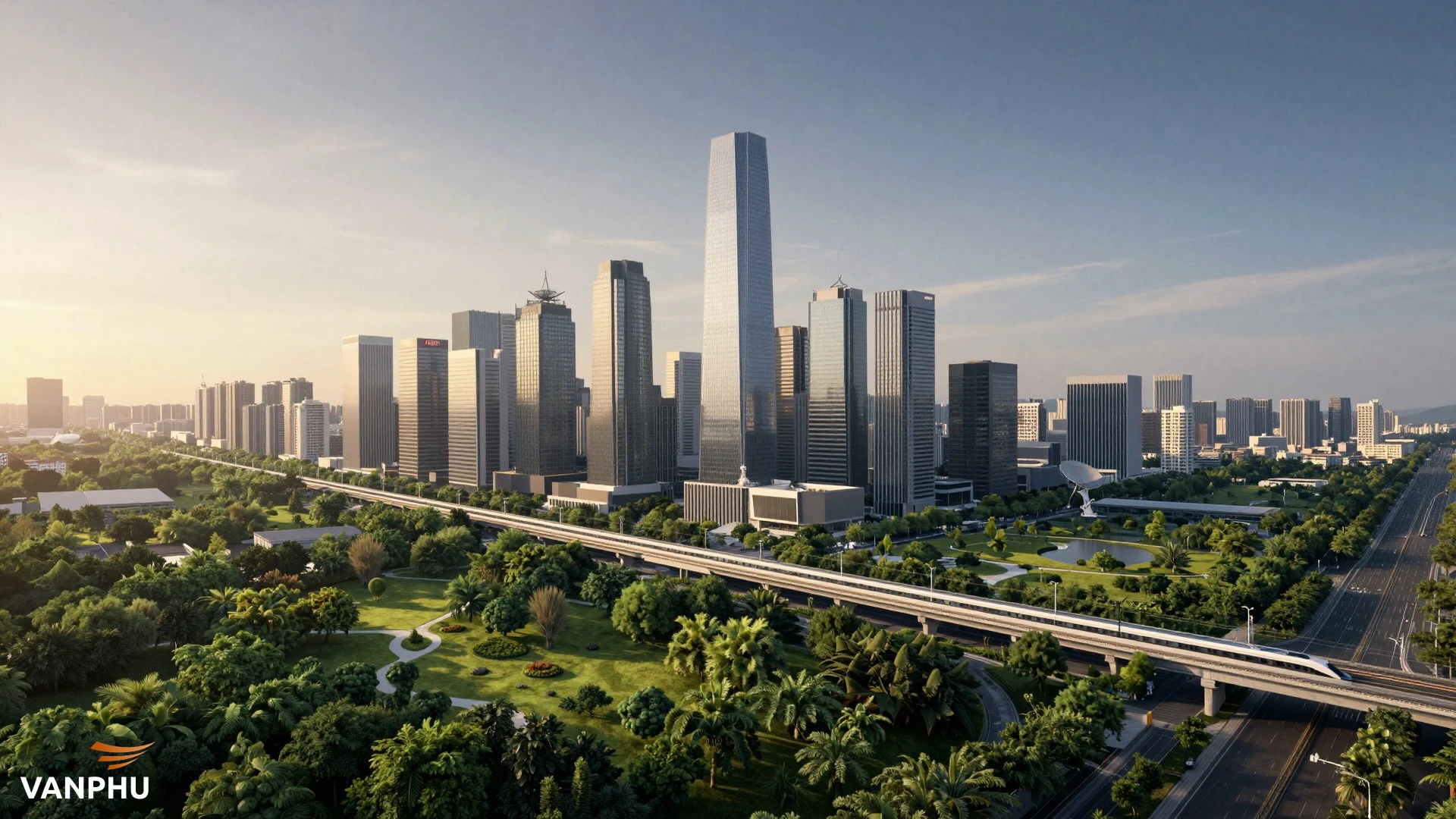
Hoa Lac has already shown clear progress as a specialized urban pole. It is home to the Hoa Lac Hi-Tech Park and Vietnam National University. These institutions attract a highly skilled workforce and thousands of students. Consequently, the demand for modern housing and commercial services in Hoa Lac is skyrocketing [3].
The government is prioritizing infrastructure to connect Hoa Lac with the central core. The Thang Long Avenue provides a direct link, reducing travel time significantly. As more tech companies set up operations here, Hoa Lac is becoming a self-sustaining ecosystem. It is a prime example of how a specialized satellite can thrive.
Why is Soc Son vital for airport-led urban growth?
Soc Son's development is inextricably linked to Noi Bai International Airport. The vision for this area is to become a "logistics city." By integrating industrial zones with aviation services, Soc Son will become a gateway for international trade. This creates a massive demand for warehousing, hotels, and worker housing [3].
Furthermore, Soc Son is connected to the Hanoi-Thai Nguyen highway. This link facilitates a supply chain for electronics and semiconductors. As Vietnam becomes a global manufacturing hub, the role of Soc Son as a satellite city becomes even more critical. Developers focusing on industrial real estate will find this area particularly attractive.
How does the two-tier government model impact urban restructuring?
Starting July 1, 2025, Hanoi will operate under a two-tier local government model. This administrative reform is a major milestone for urban planning. It streamlines the bureaucracy by organizing the city into 126 administrative units at the ward and commune levels. This change removes the district-level intermediary, allowing for more direct coordination [1].
This model facilitates "integrated planning." It allows the city to implement zoning and infrastructure projects more rapidly. For project developers, this means a more transparent and efficient legal corridor. The two-tier government model in Hanoi provides the legal foundation needed to realize the satellite city vision [1].
With clearer administrative boundaries and responsibilities, the city can better manage land use. This is crucial for preventing spontaneous, unplanned growth. Instead, the government can guide developers toward designated growth poles. This ensures that every new project aligns with the broader master plan for the capital.
Why is regional connectivity essential for satellite city success?
A satellite city cannot function in isolation. Its success depends entirely on its connection to the core and other satellites. Therefore, the government is investing heavily in "centripetal" infrastructure. This includes ring roads, highways, and urban railway lines that tie the region together [4].
The 100-year vision for Hanoi emphasizes its role as a regional leader. It must lead the development of the Red River Delta and the Northern Key Economic Zone. To achieve this, Hanoi is building strong links with neighboring provinces like Thai Nguyen, Bac Ninh, and Hung Yen [4].
- Thai Nguyen serves as a high-quality medical and educational center for the northern mountainous region.
- Bac Ninh and Tu Son form a continuous industrial-service chain, supporting Hanoi's manufacturing needs.
- Hung Yen provides essential logistics and housing for experts working in the eastern part of the capital.
These neighboring cities act as "counterweight" satellites. They share the burden of population growth and industrial production. For developers, this regional approach opens up markets beyond the administrative borders of Hanoi. It creates a vast, interconnected economic zone with immense potential.
How can project developers benefit from satellite urban expansion?
The expansion into satellite cities offers several strategic advantages for real estate developers. First, land prices in these areas are generally lower than in the city center. This allows for more competitive pricing and better profit margins. Second, the availability of large land parcels enables the creation of comprehensive "all-in-one" townships.
Modern consumers are increasingly looking for green spaces and better air quality. Satellite cities provide the perfect environment for such developments. Developers can integrate smart technologies and sustainable building practices from the ground up. This aligns with the global trend of how climate change reshapes real estate for ESG investors.
Furthermore, the rise of new PropTech platforms is making it easier to market these peripheral projects. Virtual tours and digital sales platforms allow developers to reach buyers who may not be able to visit the site in person. This technological adoption is crucial for the success of satellite developments located further from the traditional center.
What are the primary challenges in developing satellite infrastructure?
Despite the potential, satellite city development faces significant hurdles. The most pressing issue is the "infrastructure gap." While plans are ambitious, the actual construction of roads and railways often lags behind residential development. Without reliable transport, these cities risk becoming "ghost towns" where people own property but do not live [3].
Another challenge is the provision of social services. For a satellite city to be truly independent, it must offer high-quality schools, hospitals, and entertainment. If residents still have to travel to the center for basic needs, the satellite model fails. Developers must often take on the burden of building these facilities themselves to attract residents.
Finally, there is the issue of legal synchronization. Moving from a monocentric to a polycentric model requires a complete overhaul of existing regulations. The legal framework for satellite cities must be clear and consistent to give investors confidence. Any ambiguity in land use rights or planning permissions can lead to costly delays [3].
How does the 100-year vision shape Hanoi's future growth?
The 100-year vision for the capital is not just about the next decade. It is about establishing Hanoi as a global metropolis by 2145. This requires a shift in mindset from short-term gains to long-term sustainability. The goal is to create a capital that is not only a political center but also a driver of innovation and high-tech growth [4].
This vision demands a "centripetal" structure where the core and satellites work in perfect harmony. The city must be resilient to environmental changes and economic shifts. By planning for the next century, Hanoi is ensuring that its current infrastructure investments will remain relevant for generations to come.
For developers, this means focusing on quality and durability. Projects must be designed to withstand the test of time. This includes using high-quality materials, incorporating green spaces, and ensuring flexibility for future technological upgrades. The 100-year vision is a call to action for developers to build the legacy of the nation.
Why is sustainable development the core of modern satellite towns?
Sustainability is no longer an option; it is a necessity. Modern satellite cities must be designed with a low carbon footprint. This involves promoting public transport, reducing waste, and maximizing energy efficiency. The "Garden City" roots of the satellite concept are more relevant today than ever before [2].
Sustainable satellite towns offer a better quality of life. They provide residents with clean air, quiet neighborhoods, and easy access to nature. This "green" appeal is a major selling point for developers. In an era of increasing environmental awareness, sustainable projects are more likely to attract high-value investors and residents.
Moreover, the government is offering incentives for green building projects. Developers who prioritize sustainability can benefit from faster approvals and better financing options. By embracing this trend, the real estate sector can contribute to Vietnam's goal of achieving net-zero emissions by 2050.
What is the future of urban expansion in Vietnam?
The future of urban expansion in Vietnam lies in the successful integration of satellite cities. The transition from a single-core city to a multi-polar region is inevitable. It is the only way to manage the rapid urbanization that the country is experiencing. By 2045, the map of Hanoi will look vastly different, with vibrant hubs thriving in every direction [1].
Project developers will play a central role in this transformation. They are the ones who will turn these plans into reality. By understanding the strategic goals of the government and the needs of the modern resident, they can create urban spaces that are both profitable and socially responsible.
In conclusion, satellite city development is a complex but rewarding endeavor. It requires a combination of visionary planning, robust infrastructure, and innovative development. As Vietnam continues its journey toward becoming a high-income nation, these satellite cities will be the engines of its growth and the symbols of its progress.
More Information
- Satellite City: An urban area located near a major central city that functions as an independent hub with its own services and economic drivers.
- Polycentric Model: An urban planning strategy that organizes a city into multiple centers or growth poles to distribute population and economic activity.
- Garden City: A method of urban planning in which self-contained communities are surrounded by "greenbelts," containing proportionate areas of residences, industry, and agriculture.
- Two-tier Government: A restructured administrative model that simplifies city management by removing certain intermediate levels of bureaucracy to improve coordination.
- Logistics Hub: A designated area specifically designed for the storage, management, and distribution of goods, often located near major transport links like airports or ports.